October 10, 2010

Hacklebarney State Park

I went to Hacklebarney twice  - the first time was in Mid September.  Many people had recommended this as a great place to hike, so I was really looking forward to it.  The weather that weekend was great!  Perfect early fall weather, foliage was starting to turn.  I took my faithful HP Photosmart camera, which took some great pics.  We had a wonderful time - followed the main trail then branched off to the yellow trail, followed that till it met back up with the white and red trails, then took the red back.  When I got home, I went to upload the pics - and somehow lost them all.  There was only one showing and it was corrupted.  I tried testing my camera again and this time it was acting strange - turning off (not shutting down but just blacking out) after a few seconds.  I sadly realized that it was time to get a new camera. 

After a bit of research and looking at prices, I headed off to Best Buy and returned with a Sony Cybershot.  I took it out the next day when we went to Hacklebarney again.  The pictures weren't nearly as good as the ones with the old camera, in my opinion.  You can see for yourself.  They were very dark, and blurry.


 Hacklebarney has some paved paths, and other more "rustic" paths that are for more of a "hiking" experience, but none of the trails are particularly difficult.  If you want a nice nature walk with beautiful scenery, without worrying about tripping over roots and rocks, come here.
 We followed the red trail, which follows the Black River, first taking the upper trail, then the lower trail back to the parking lot.  The lower red trail was part of what we did the last time. 

 Here you can see the wide, paved paths.


Beautiful, but not much of a workout!!  Though we did get a good 3 mile walk or so.  Just not many hills or anything.  After the hike in September I stopped at the Hacklebarney Cider Mill and got some delicious cider and donuts!  I wanted to stop there again, but didn't because it was crazy crowded!  They were having some sort of shindig there.

September 10, 2010

Washington Valley Park - Yellow Trail

A few days later we headed back to Washington Valley Park.  With the park map now in hand, it was much easier to find my way into the other side's parking lot.  The Orange trail connects only to the road and not the parking lot, so I avoided it because I didn't want to walk along the road, nor park off the side of it.  So we explored the Yellow trail.

The first thing we did was head down towards the hawk watch.  There were several people there.  It over looked a noisy stone quarry.  If it had been on the weekend, maybe it wouldn't have been so bad.  But it was not really relaxing, so we left quickly.  I could also tell some of the people on the platform did not like having Sammy around. 

There was a little waterfall, but I couldn't get a good angle on it.

Above the falls
We walked along the river for a time.  

The hiking was mostly fairly easy, slightly rocky near the river but not too bad.  Then it went upwards and through forest.  It was quiet - not many animals like last time.  Pleasant.


Along the river

Right near here, we saw a pair of heron.  So beautiful!  They were flying though, and I didn't get my camera out fast enough.


We did see a deer on our way out though!  He was making lunch out of someone's lawn.

September 5, 2010

Washington Valley Park - Red & White trails

Heard about this park on njhiking.com, as part of their short hikes section.  It was nearby, so I figured it was perfect for us.  It was a bit hard to find!  But eventually we managed to get in.

Washington Valley Park is shaped sort of like a butterfly.  I had intended on going to the east "wing" but ended up in the western one instead. The west "wing" has 3 trails - Red, White and Blue.  The east "wing" has Yellow and Orange.  The west side at least is very popular with mountain bikers, so if you plan to hike there be aware of them.  The trails can be a bit confusing because there are "perimiter" trails and "interior" trails.  One is marked with square blazes, the other with circles. 

 We asked a biker in the parking lot which trail he thought was best,  he basically indicated the blue or red trails.  I headed out on Red. This trail follows the resevoir for a bit, then curves up and through the forest.  

 Going uphill, we saw this in the "valley" below the trail.

 Sammy and I stopped to watch some hawks soar over the quarry.

 Most of this was just dense forest.  Quiet away from the parking lot, though we did see other people.

 
We crossed the little bridge and kept going onto the White trail.  On the White trail we saw a LOT of wildlife, including many deer!  I had seen a 2 snakes (one of whom was eating a frog) on the Red trail, but this was really nice.  I got quite close to a couple of them, and twice a group of them came out of the woods to jump over the trail about 20-30 feet in front of us.  My cell phone camera is crap though, so sadly I didn't get any good pics. 


 Length:  ?? Can't seem to find any listings.  Elevation: Minimal. 

August 20, 2010

Maine Hiking - Schoodic Mountain

A week after Blue Hill, we tackled another mountain.  This time we went east instead of south, to the Donnell Pond preserve.  It was a bit hard to find, and once I finally found the road in I wasn't aware of just how long you had to go on this narrow dirt road, when large dump trucks would come flying out from nowhere.  It was a bit nerveracking and I almost turned around, but just when I thought I should go back, a parking lot came into view!  There were 12 or 18 cars there, and an outhouse (yay!) and kiosk.  I put on my boots and after Sammy had done his thing, headed down the trail to the beach.


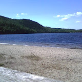
The beach was GORGEOUS.  It was a beautiful day, absolutely perfect.  There were a few families/groups on the beach, maybe 4 or 5, but it was quiet except for a couple kids playing.  I ate my PB&J and enjoyed the view while Sammy lay in the sand.  I was surprised it was so sandy.  I got out my camera to take some pics and found that the new rechargeable batteries my mother had bought were crap.  They'd been charging several days and let me take 3 pictures before they died.  Lesson learned: always pack extra batteries. 

We then walked up the beach and headed toward the trail that went up Schoodic Mtn.  It was easy enough at first, and beautiful.  It was by far my favorite place to hike in Maine (so far) but hey, I haven't been that many places.  It got a bit steeper and I just took it slow.  There seemed to be a lot of people coming down.  Several of them seemed to have nothing but flip flops on.  I was shocked. The older folks seemed to be huffing and puffing, the kids acting like they were taking a sunday stroll.


We climbed and climbed, eventually coming to a point where we were climbing over boulders.  We met the lady we had talked to the the parking lot, who didn't seem all that friendly then but did now.  She told me it was 10 or 15 more minutes.   10 or 15 minutes later we met another couple, who insisted it was only 10 or 15 more minutes.   Climbed for another while.  We then met a third group, a family that also had a dog, who also said it was 10 or 15 minutes.  Jeepers. 


Eventually we got there, it actually was I think, less difficult to get up than Blue Hill, the last part of it anyway, though it was much longer.  The first lady, the parking lot lady, when I told her I'd come up from the beach said "Oh yeah, that way's brutal."  Great.  I seem to have a knack for picking out the worst trails. 


The summit (this time I was sure it was the summit!) was worth it.  It was spectacular.  I am angry still that I had to take my pictures of it with my cell phone camera. 

The trail back to the parking lot was much easier I must say, though to be honest I prefer going up the hard way.  My fear of heights makes it difficult to stomach scampering down piles of rocks on the side of a mountain.


Length: Aprox 3 miles.  Elevation: About 1000 feet. 


Schoodic Mtn Hike - Aug 20 2010

August 13, 2010

Maine Hiking - Blue Hill

One August morning when I was feeling particuarly peppy and motivated, I decided to actually tackle some *real* hiking, and go climb Blue Hill, one of the "classic" Maine hikes, popular with tourists, as it right on the coast and overlooks the coastline and Acadia.  Beautiful place.  It was a bit warm but I didn't think it was that bad - upper 70s.

I found it with some difficulty, but eventually got it.  I drove right past the sign I was looking for (I didn't see it till we left), so I missed the left turn, went downtown and got all turned around in the tourist traffic, and went up another road the guide book said would work, turned at the road across from the fairgrounds like it said, and there it was.  There were many other people there, a lot of them tourists with out of state plates.  I guess that included me!


We started up the long slow incline part and I was already puffing by the time we got to the info kiosk.  I stopped to read all the info, and study the map (there was none to take with me so I had to rely on memory) and take some pictures.  We were already up far enough that there was a good view. 


From this point I had 2 options - a service road or the Hayes Trail.  I decided to take the Hayes trail (which I regret now!).  This involved climbing what I think they said was 400 stairs.  At the top, I had the option of taking the long way around or going straight up.  My original plan was to take the short route up and the long way down so I could enjoy the view on the descent.   But I was so tired after 400 stairs that I decided to switch it.  I followed what was called the South Face trail which was supposed to meet up with the other trail that came up the other side, the Osgood trail but after some time I thought I was going down the mountain and figured I'd made some sort of wrong turn and had gotten on the trail going back down instead of up.  But backtracking didn't show me another trail so I guess I was wrong.  Now I could either say forget it and go down the stairs or go up.  Of course I went up! After some water and a snack of course.  And some more pictures.

The trail to the summit was undergoing renovations. Apparently the new trail is much more difficult (this was said by some people going down that I crossed paths with).  At first it wasn't too bad, then it started getting very steep and rocky.  Still wasn't that bad.  One last part was on a narrow ledge which scared me.  But after we came around the bend on the ledge we were faced with what looked like a pile of rocks.


I was like, forget it!  No way!  and so Sammy and I had a rest before we went down.


Then a couple of minutes later, a 12 ish year old boy comes scampering along and practically hops up the wall of rocks like it was the stairway to his girlfriends bedroom.  Well!  If that kid could do it so easily surely I could manage it.  So I tackled it.  It wasn't quite so easy for me.  I'm old, fat and filled with the kind of fear that old fat people hiking alone on the mountain with only a 20 lb dog that won't bark and you know, isn't Lassie and isn't going to go running for help can feel.  I struggled mightily and had just about given up when a man and his about 8 year old daughter come into view going down.  Me, redfaced, sweaty and breathing heavily watch in awe and disbelief in the realization that this child climbed up here and seemed fine, not even out of breath.  Man I was pathetic.  I told them I was planning on turning back and they were like "oh no, its right here, another 20 feet or so, you can do it!"


I do not know if I ever actually made it to the top.  I made it to some sort of ledge/clearing place.  I didn't see a sign saying it was the summit, but I didn't see where the trail went after that, though there was supposed to be a tower and the service road there as well.  ???  I called it good enough and started back down.  I almost cried twice on the way back down that wall of rocks.  I was terrified that at best I'd sprain my ankle and at worst I'd fall down and crack my skull on these rocks. But I survived.  Halfway down an older man came up and told me there was an easier way down - but I'd have to go all the way back up first.  Great.  We opted for continuing the way we came. We saw him in the parking lot while I was stretching and the easier way was the service road.  Maybe next time.

This hike was definitely a step up for me on difficulty!  I was sore for days, but proud.  The next week I tackled another small mountain/big hill.

Length:  2 miles (1 up, 1 down) + whatever I did on the South Face trail.